
Experience & Skills
I am a Geospatial Analyst with 10 years of experience with geospatial methods and tools. I’m working on focusing away from just static mapmaking and more towards automated, code-driven insights using cloud-native tools and data formats. For more information see my ‘About’ section!
I would love to connect with you on LinkedIn. Send me a connection request and let’s talk!
Also be sure to check out my personal projects I have been working on!
| Domain | Tools & Technologies |
|---|---|
| Programming | Python (Pandas / GeoPandas, Rasterio, ArcPy), SQL (PostgreSQL, PostGIS, DuckDB, SedonaDB) |
| Analysis | Spatial Statistics, Viewshed Analysis, DEM and LiDAR Processing |
| Automation | ArcGIS Pro SDK, ETL Pipelines |
| Desktop | ArcGIS Pro, QGIS |
| Cloud | AWS S3 and CLI, Geoparquet, Cloud Optimized GeoTIFFs (COGs) |
Featured Projects
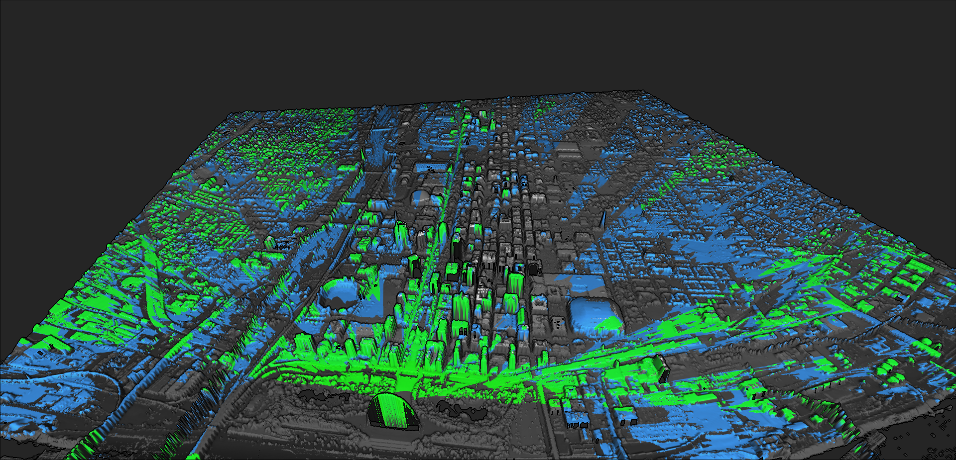
St. Louis Viewshed Analysis (aka ‘Million Dollar View Validator’)
Quick geospatial analysis pipeline that computes and visualizes a viewshed to the Gateway Arch for a ‘million dollar view’
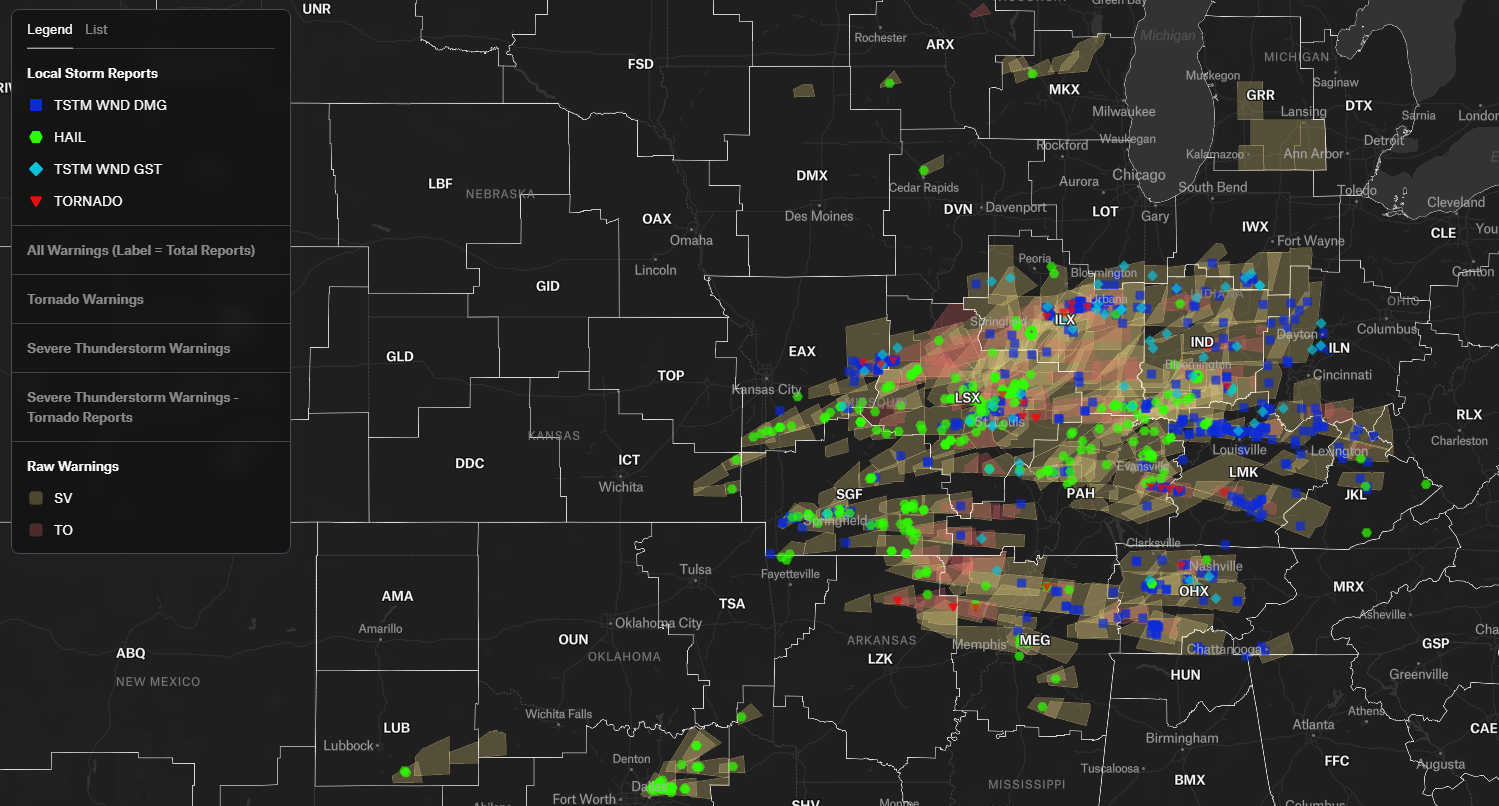
StormVerify-Py: Automated NWS Warning Verification & Spatial Audit
A spatial data pipeline that evaluates the accuracy of NWS convective warnings by joining them against ground-truth Local Storm Reports (LSRs) using DuckDB’s...
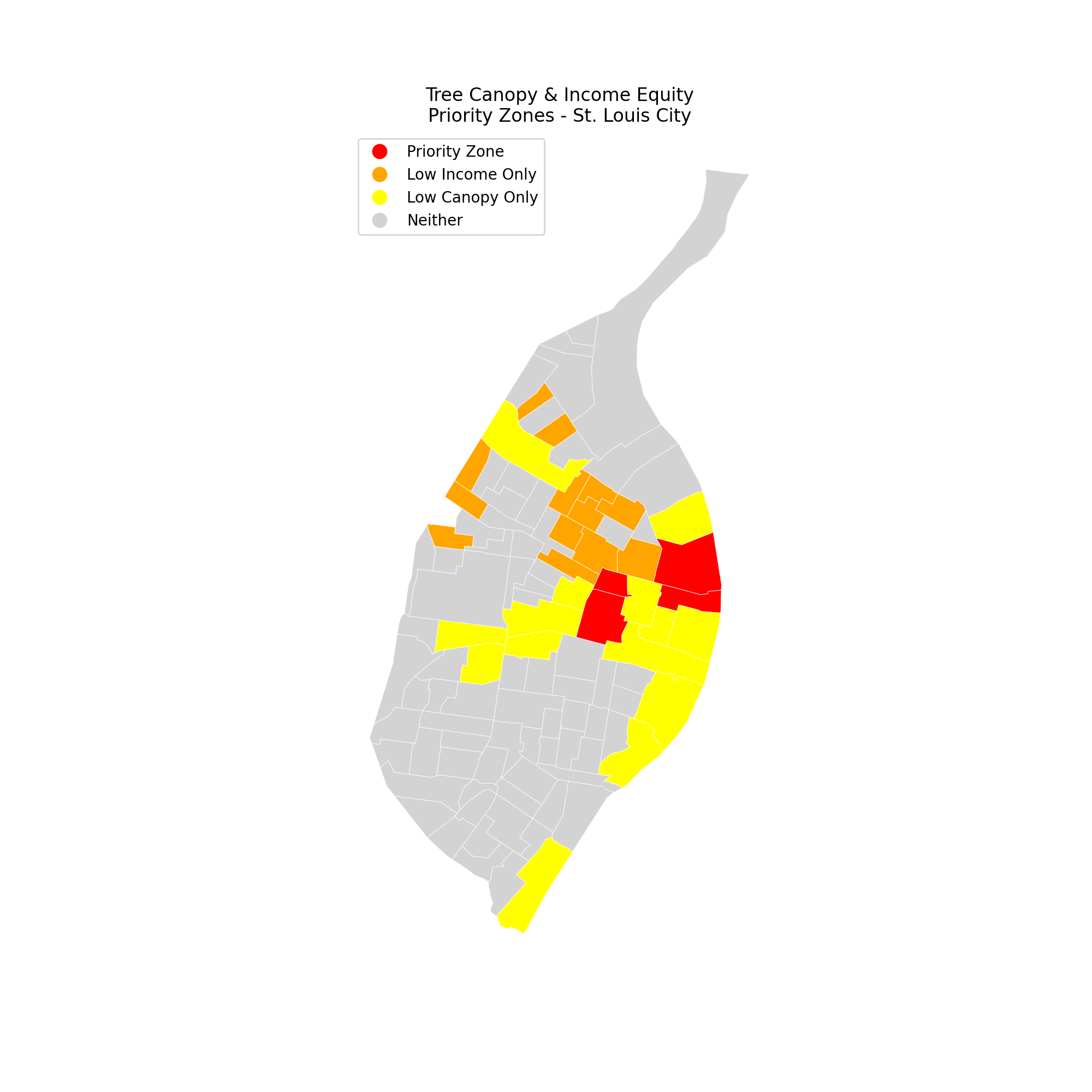
Urban Shade and Income Analysis - St. Louis, MO
Analyzing tree canopy equity in St. Louis City using NLCD 2023 raster data + ACS 5-year estimates.